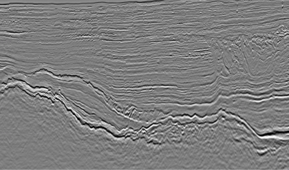
After survey data is acquired, environmental noise (e.g., information on currents and wave swells) in the survey data is removed and processed by supercomputers installed on board and on land, and scientific calculations are performed to visualize the subsurface structure more clearly.
OGF will create a fully customized workflow for your dataset’s unique challenges using this experience, providing the best subsurface image for interpretation.
OGF Imaging also has the full support of TGS Imaging and the full SPArK imaging tool (Includes multiple applications and tools), providing clients with the top in class imaging result.
Our data center (location of the supercomputer) located in Japan has all the computing power needed to provide reliable imaging solutions quickly to clients both in Japan and internationally.

*1 Processing sequence refers to a series of steps designed to transform raw data into useful information. In geophysical exploration, it involves multiple processing steps, such as filtering, denoising, and migration, to analyze seismic, gravity, or other geophysical data.
